
Talaksan:Confini della Basilicata.png
Laki ng pasilip na ito: 722 x 600 na pixel. Ibang resolusyon: 289 x 240 na pixel | 578 x 480 na pixel | 934 x 776 na pixel.
Buong resolusyon ((934 × 776 pixel, laki ng talaksan: 1.3 MB, uri ng MIME: image/png))
|
|
Ito ay isang talaksan mula sa Wikimedia Commons. Makikita sa ibaba ang impormasyon mula sa pahina ng paglalarawan nito roon. |
Buod
| Paglalarawan |
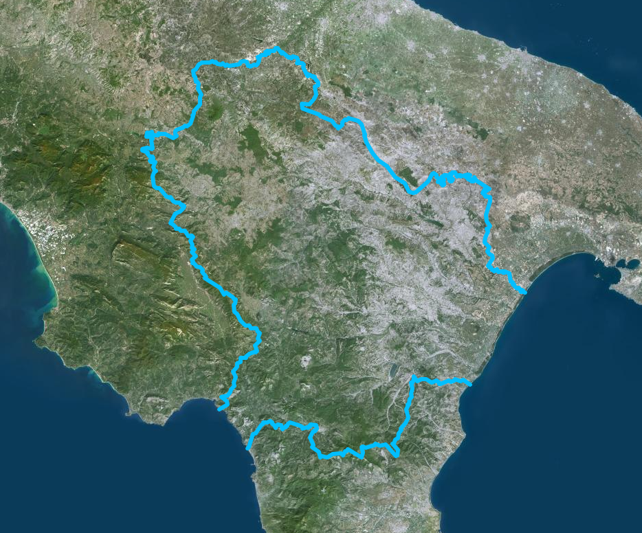
Italiano: Confini della Basilicata - Mappa di Institut géographique national |
| Petsa | |
| Pinanggalingan | https://www.geoportail.gouv.fr/donnees/photographies-aeriennes |
| May-akda | Institut National de l'information geographique et forestiere |
Paglilisensiya
| This file is licensed under the Licence Ouverte 1.0 (License text, English license text).
|
Nakaraan ng file
Pindutin ang araw/oras upang makita kung papaano ang itsura ng talaksan noong oras na iyon.
| Araw/Oras | Thumbnail | Mga dimensiyon | tagagamit | Kumento | |
|---|---|---|---|---|---|
| ngayon | 13:54, 13 Hulyo 2020 | | 934 × 776 (1.3 MB) | Sayatek | Uploaded a work by Institut National de l'information geographique et forestiere from https://www.geoportail.gouv.fr/donnees/photographies-aeriennes with UploadWizard |
Mga ugnay
Nakaturo sa talaksan na ito ang mga sumusunod na mga pahina:
Pandaigdigang paggamit sa file
Ginagamit ng mga sumusunod na wiki ang file na ito:
- Paggamit sa ar.wikipedia.org
- Paggamit sa ast.wikipedia.org
- Paggamit sa az.wikipedia.org
- Paggamit sa ca.wikipedia.org
- Paggamit sa cs.wikipedia.org
- Paggamit sa cy.wikipedia.org
- Paggamit sa de.wikivoyage.org
- Paggamit sa diq.wikipedia.org
- Paggamit sa fr.wikivoyage.org
- Paggamit sa ga.wikipedia.org
- Paggamit sa gd.wikipedia.org
- Paggamit sa gl.wikipedia.org
- Paggamit sa he.wikipedia.org
- Paggamit sa hy.wikipedia.org
- Paggamit sa ia.wikipedia.org
- Paggamit sa id.wikipedia.org
- Paggamit sa ilo.wikipedia.org
- Paggamit sa it.wikipedia.org
- Paggamit sa ka.wikipedia.org
- Paggamit sa ku.wikipedia.org
- Paggamit sa lld.wikipedia.org
- Paggamit sa lmo.wikipedia.org
- Paggamit sa mzn.wikipedia.org
- Paggamit sa nn.wikipedia.org
- Paggamit sa no.wikipedia.org
- Paggamit sa oc.wikipedia.org
- Paggamit sa pl.wikipedia.org
- Paggamit sa ps.wikipedia.org
- Paggamit sa pt.wikipedia.org
- Paggamit sa ro.wikipedia.org
- Paggamit sa ru.wikipedia.org
- Paggamit sa sl.wikipedia.org
- Paggamit sa sr.wikipedia.org
- Paggamit sa tg.wikipedia.org
- Paggamit sa tt.wikipedia.org
- Paggamit sa vec.wikipedia.org
- Paggamit sa vi.wikipedia.org
- Paggamit sa www.wikidata.org