
Talaksan:Map-Latin America.png

Buong resolusyon ((1,272 × 645 pixel, laki ng talaksan: 150 KB, uri ng MIME: image/png))
|
|
Ito ay isang talaksan mula sa Wikimedia Commons. Makikita sa ibaba ang impormasyon mula sa pahina ng paglalarawan nito roon. |

|
This linguistic map image could be re-created using vector graphics as an SVG file. This has several advantages; see Commons:Media for cleanup for more information. If an SVG form of this image is available, please upload it and afterwards replace this template with
{{vector version available|new image name}}.
It is recommended to name the SVG file “Map-Latin America.svg”—then the template Vector version available (or Vva) does not need the new image name parameter. |
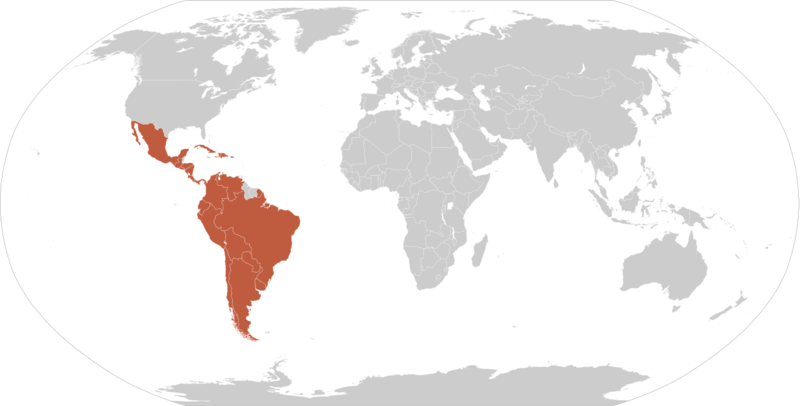
Buod

.
Map of en:Latin america. Thanks to write in the talk page if it's need to improve it. An alternative image is Image:Map-Latin America2.png.
Map made from Image:BlankMap-World.png
Paglilisensiya
| Ang akdang ito ay pinakawalan sa sakop ng madla ng may-akda nito, si Yug. Magagamit ito sa buong daigdig. Maaaring hindi ito posibleng legal sa ilang mga bansa; kung ganito: |
Nakaraan ng file
Pindutin ang araw/oras upang makita kung papaano ang itsura ng talaksan noong oras na iyon.
| Araw/Oras | Thumbnail | Mga dimensiyon | tagagamit | Kumento | |
|---|---|---|---|---|---|
| ngayon | 04:33, 14 Mayo 2016 | | 1,272 × 645 (150 KB) | Elevatorrailfan | Fixing |
| 03:07, 14 Mayo 2016 |  | 1,272 × 645 (149 KB) | Elevatorrailfan | No need to have Brazil and French speaking countries in a separate shade. | |
| 16:02, 20 Marso 2011 |  | 1,356 × 688 (158 KB) | Philip Stevens | The Falkland Islands, South Georgia and the South Sandwich Islands are not part of Latin America. | |
| 07:33, 12 Marso 2010 |  | 1,356 × 688 (167 KB) | Fenixt | (Iberoamérica. Nombre que recibe el conjunto de países americanos que formaron parte de los reinos de España y Portugal http://buscon.rae.es/dpdI/SrvltConsulta?lema=iberoam%C3%A9rica) | |
| 04:19, 28 Oktubre 2008 |  | 1,357 × 628 (25 KB) | Denis C.~commonswiki | Reverted to old version because previous image had Quebec colored on the map but with very inaccurate border lines. Also, Quebec is not even considered a part of Latin America according to the article about the latter and its inhabitants don't consider it | |
| 07:05, 20 Oktubre 2008 |  | 1,357 × 628 (29 KB) | Pruxo | guyana not exactly part (french colony) Belize english origin, Quevec french culture, (as martinica, haiti, etc) | |
| 16:32, 17 Setyembre 2008 |  | 1,357 × 628 (16 KB) | Chesnok | {{Information |Description= |Source= |Date= |Author= |Permission= |other_versions= }} | |
| 13:13, 10 Disyembre 2005 |  | 1,357 × 628 (25 KB) | Yug | Map of en:Latin america. Thanks to write in the talk page if it's need to improve it. en:Latin america fr:Amérique latine Map made from Image:BlankMap-World.png {{PD-user|Yug}} Category:World maps |
Mga ugnay
Nakaturo sa talaksan na ito ang mga sumusunod na mga pahina:
Pandaigdigang paggamit sa file
Ginagamit ng mga sumusunod na wiki ang file na ito:
- Paggamit sa arc.wikipedia.org
- Paggamit sa be-tarask.wikipedia.org
- Paggamit sa bn.wikipedia.org
- Paggamit sa br.wikipedia.org
- Paggamit sa ceb.wikipedia.org
- Paggamit sa cs.wikipedia.org
- Paggamit sa dv.wikipedia.org
- Paggamit sa en.wikipedia.org
- Paggamit sa eo.wikipedia.org
- Paggamit sa eo.wikinews.org
- Paggamit sa es.wikipedia.org
- Paggamit sa fr.wikipedia.org
- Paggamit sa fr.wikinews.org
- Paggamit sa fy.wikipedia.org
- Paggamit sa ga.wikipedia.org
- Paggamit sa gl.wikipedia.org
Tingnan ang karagdagang pandaigdigang paggamit sa file na ito.