
Talaksan:PudongSkyline-pjt.jpg

Laki ng pasilip na ito: 800 x 243 na pixel. Ibang resolusyon: 320 x 97 na pixel | 640 x 195 na pixel | 1,024 x 311 na pixel | 1,280 x 389 na pixel | 5,792 x 1,761 na pixel.
Buong resolusyon ((5,792 × 1,761 pixel, laki ng talaksan: 2.3 MB, uri ng MIME: image/jpeg))
|
|
Ito ay isang talaksan mula sa Wikimedia Commons. Makikita sa ibaba ang impormasyon mula sa pahina ng paglalarawan nito roon. |
Buod
| Paglalarawan |
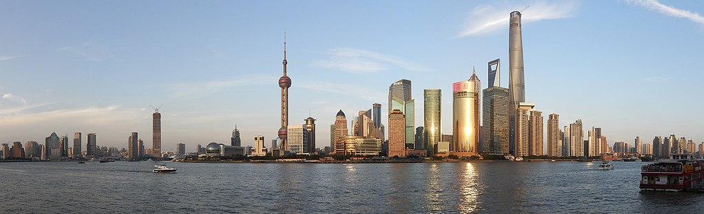
Deutsch: Skyline von Pudong, Shanghai, China English: Pudong skyline, Shanghai, China
This image was created with Hugin. |
||
| Petsa | |||
| Pinanggalingan | Sariling gawa | ||
| May-akda | Pjt56 --- If you use the picture outside Wikipedia I would appreciate a short e-mail to pjt56@gmx.net or a message on my discussion page |

| Camera location | | View this and other nearby images on: OpenStreetMap |
|---|
Paglilisensiya
Ako, na may karapatang-ari ng akdang ito, ang naglalathala nito alinsunod sa ilalim ng sumusunod na mga lisensya:
Ang talaksang ito ay nakalisensiya sa ilalim ng lisensiyang Creative Commons Atribusyon-Pagpapamahaging Magkatulad 4.0 Pandaigdig.
- Malaya kang:
- para ibahagi – para kopyahin, ipamahagi, at i-transmit ang akda
- para i-remix – para i-adapt ang akda
- Sa ilalim ng mga kondisyong ito:
- atribusyon – Dapat magbigay ka ng isang maayos na pag-credit, ibigay ang link sa lisensiya, at tukuyin kung may mga pagbabagong ginawa. Magagawa mo ito sa isang risonableng paraan, pero hindi sa paraan na para bang ineendorso ka o ng paggamit mo ng naglisensiya sa'yo.
- share alike – Kung ire-remix mo, babaguhin, o magdadagdag ka sa materyal, dapat mong ipamahagi ang mga ambag mo sa ilalim ng pareho o katulad na lisensiya.
| Annotations | This image is annotated: View the annotations at Commons |
Nakaraan ng file
Pindutin ang araw/oras upang makita kung papaano ang itsura ng talaksan noong oras na iyon.
| Araw/Oras | Thumbnail | Mga dimensiyon | tagagamit | Kumento | |
|---|---|---|---|---|---|
| ngayon | 12:01, 9 Nobyembre 2014 | 5,792 × 1,761 (2.3 MB) | Pjt56 | User created page with UploadWizard |
Mga ugnay
Nakaturo sa talaksan na ito ang mga sumusunod na mga pahina:
Pandaigdigang paggamit sa file
Ginagamit ng mga sumusunod na wiki ang file na ito:
- Paggamit sa bg.wikipedia.org
- Paggamit sa da.wikipedia.org
- Paggamit sa de.wikipedia.org
- Paggamit sa en.wikipedia.org
- Paggamit sa et.wikipedia.org
- Paggamit sa fi.wikipedia.org
- Paggamit sa fr.wikipedia.org
- Paggamit sa pt.wikipedia.org
- Paggamit sa sl.wikipedia.org
- Paggamit sa sr.wikipedia.org
- Paggamit sa vi.wikipedia.org