
Talaksan:125.39255E 38.73470N Port of Nampho.png

Laki ng pasilip na ito: 800 x 543 na pixel. Ibang resolusyon: 320 x 217 na pixel | 640 x 435 na pixel | 1,022 x 694 na pixel.
Buong resolusyon ((1,022 × 694 pixel, laki ng talaksan: 1.28 MB, uri ng MIME: image/png))
|
|
Ito ay isang talaksan mula sa Wikimedia Commons. Makikita sa ibaba ang impormasyon mula sa pahina ng paglalarawan nito roon. |
| Paglalarawan |
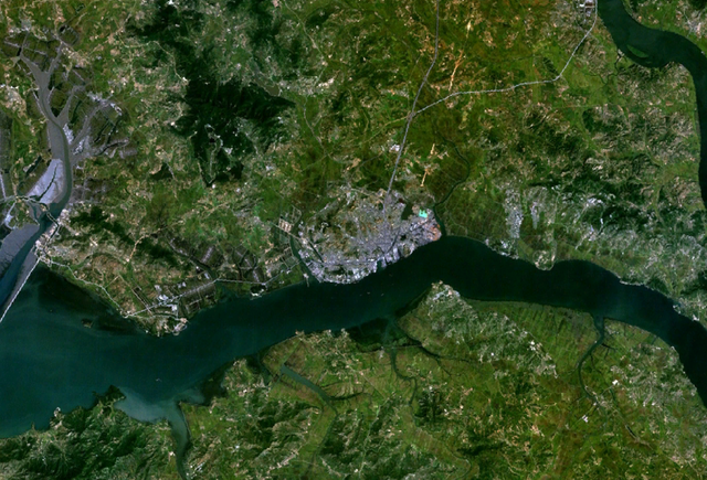
English: Satellite shot showing the port of Nampho, North Korea (the gray mass near the center of the image), from an altitude of 17.5 km. |
|||
| Petsa | date of dataset | |||
| Pinanggalingan | Created with NASA WorldWind by User:Oaktree_b using Landsat 7 (Visible Color) satellite image. | |||
| May-akda | NASA | |||
| Permiso (Muling paggamit sa file) |
|

| Object location | | View this and other nearby images on: OpenStreetMap |
|---|
Nakaraan ng file
Pindutin ang araw/oras upang makita kung papaano ang itsura ng talaksan noong oras na iyon.
| Araw/Oras | Thumbnail | Mga dimensiyon | tagagamit | Kumento | |
|---|---|---|---|---|---|
| ngayon | 02:55, 25 Hulyo 2011 | | 1,022 × 694 (1.28 MB) | Oaktree b | {{Information |Description ={{en|1=Satellite shot showing the port of Nampho, North Korea (the gray mass near the center of the image), from an altitude of 17.5 km. }} |Source =Created with NASA WorldWind by User:Oaktree_b using Landsat 7 ( |
Mga ugnay
Nakaturo sa talaksan na ito ang mga sumusunod na mga pahina:
Pandaigdigang paggamit sa file
Ginagamit ng mga sumusunod na wiki ang file na ito: