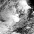
Talaksan:24W Geostationary VIS-IR 2020.png

Laki ng pasilip na ito: 600 x 600 na pixel. Ibang resolusyon: 240 x 240 na pixel | 480 x 480 na pixel | 768 x 768 na pixel | 1,024 x 1,024 na pixel | 1,280 x 1,280 na pixel.
Buong resolusyon ((1,280 × 1,280 pixel, laki ng talaksan: 1.1 MB, uri ng MIME: image/png))
Nakaraan ng file
Pindutin ang araw/oras upang makita kung papaano ang itsura ng talaksan noong oras na iyon.
| Araw/Oras | Thumbnail | Mga dimensiyon | tagagamit | Kumento | |
|---|---|---|---|---|---|
| ngayon | 09:03, 9 Nobyembre 2020 |  | 1,280 × 1,280 (1.1 MB) | Typhoon2013 | 2020-11-09 0810Z |
| 09:00, 9 Nobyembre 2020 |  | 320 × 320 (82 KB) | Typhoon2013 | Uploaded a work by Naval Research Laboratory from https://www.nrlmry.navy.mil/archdat/test/kml/TC/2020/WPAC/24W/visir/ with UploadWizard |
Mga ugnay
Nakaturo sa talaksan na ito ang mga sumusunod na mga pahina:

