
Talaksan:Angola Map.jpg
Laki ng pasilip na ito: 482 x 599 na pixel. Ibang mga resolusyon: 193 x 240 na pixel | 386 x 480 na pixel | 618 x 768 na pixel | 1,030 x 1,280 na pixel.
Buong resolusyon ((1,030 × 1,280 pixel, laki ng talaksan: 283 KB, uri ng MIME: image/jpeg))
|
|
Ito ay isang talaksan mula sa Wikimedia Commons. Makikita sa ibaba ang impormasyon mula sa pahina ng paglalarawan nito roon. |
| Paglalarawan |
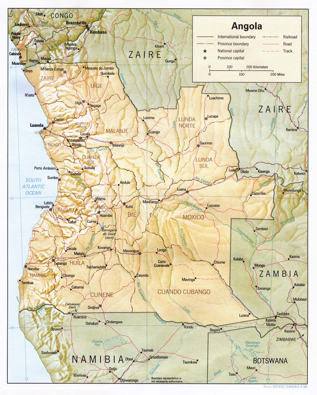
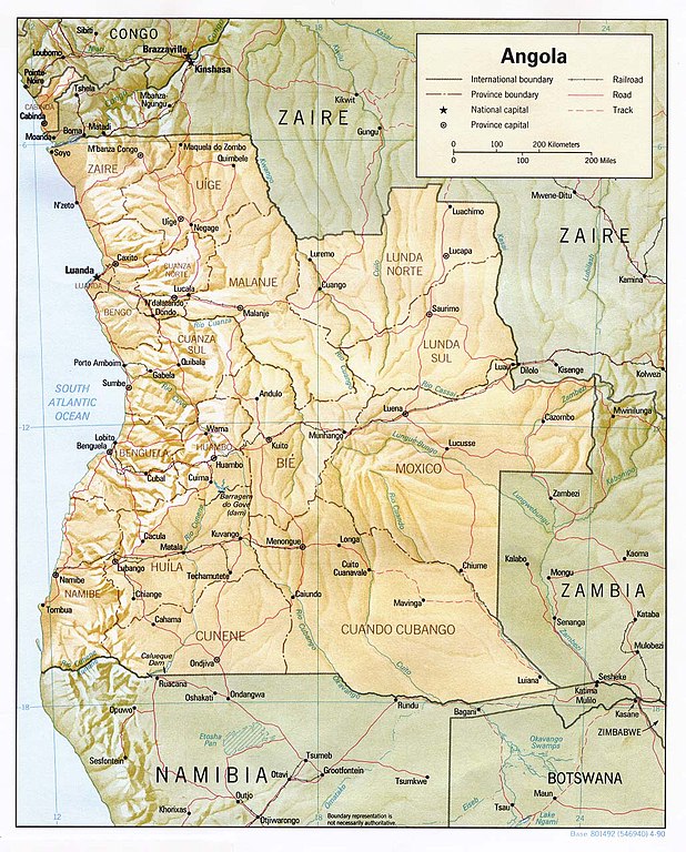
English: Shaded relief map of Angola. |
|||
| Petsa | ||||
| Pinanggalingan | [1] from the Perry-Castañeda Library Map Collection. | |||
| May-akda | CIA | |||
| Permiso (Muling paggamit sa file) |
|

![[1]](http://www.lib.utexas.edu/maps/africa/angola_rel90.jpg)
Nakaraan ng file
Pindutin ang araw/oras upang makita kung papaano ang itsura ng talaksan noong oras na iyon.
| Araw/Oras | Thumbnail | Mga dimensiyon | tagagamit | Kumento | |
|---|---|---|---|---|---|
| ngayon | 11:32, 21 Pebrero 2006 | | 1,030 × 1,280 (283 KB) | Lupo | Shaded relief map of Angola. Source: [http://www.lib.utexas.edu/maps/africa/angola_rel90.jpg] from the [http://www.lib.utexas.edu/maps/angola.html Perry-Castañeda Library Map Collection]. {{PD-USGov-CIA}} Category:Maps of Angola |
Mga ugnay
Nakaturo sa talaksan na ito ang mga sumusunod na mga pahina:
Pandaigdigang paggamit sa file
Ginagamit ng mga sumusunod na wiki ang file na ito:
- Paggamit sa ar.wikipedia.org
- Paggamit sa ast.wikipedia.org
- Paggamit sa ca.wikipedia.org
- Paggamit sa ckb.wikipedia.org
- Paggamit sa de.wikipedia.org
- Paggamit sa en.wikipedia.org
- Paggamit sa es.wikipedia.org
- Paggamit sa eu.wikipedia.org
- Paggamit sa fa.wikipedia.org
- Paggamit sa fi.wikipedia.org
- Paggamit sa fr.wikipedia.org
- Paggamit sa hu.wikipedia.org
- Paggamit sa id.wikipedia.org
- Paggamit sa incubator.wikimedia.org
- Paggamit sa it.wikipedia.org
- Paggamit sa mzn.wikipedia.org
- Paggamit sa nl.wikipedia.org
- Paggamit sa ny.wikipedia.org
- Paggamit sa pl.wikipedia.org
- Paggamit sa pt.wikipedia.org
- Paggamit sa ru.wikipedia.org
- Paggamit sa simple.wikipedia.org
- Paggamit sa sl.wikipedia.org
- Paggamit sa tr.wikipedia.org
- Paggamit sa uk.wikipedia.org
- Paggamit sa vec.wikipedia.org
- Paggamit sa www.wikidata.org
- Paggamit sa wo.wikipedia.org
- Paggamit sa zh.wikipedia.org