
Talaksan:Gambia Map.png

Laki ng pasilip na ito: 500 x 599 na pixel. Ibang resolusyon: 200 x 240 na pixel | 400 x 480 na pixel | 1,006 x 1,206 na pixel.
Buong resolusyon ((1,006 × 1,206 pixel, laki ng talaksan: 228 KB, uri ng MIME: image/png))
|
|
Ito ay isang talaksan mula sa Wikimedia Commons. Makikita sa ibaba ang impormasyon mula sa pahina ng paglalarawan nito roon. |
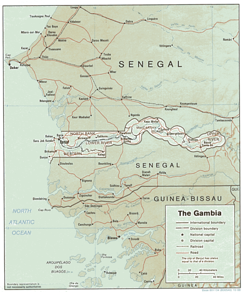
| Paglalarawan | Shaded relief map of The Gambia. | |||
| Petsa | ||||
| Pinanggalingan | [1] from the Perry-Castañeda Library Map Collection. | |||
| May-akda | CIA | |||
| Permiso (Muling paggamit sa file) |
|

![[1]](http://www.lib.utexas.edu/maps/africa/gambia.gif)
Nakaraan ng file
Pindutin ang araw/oras upang makita kung papaano ang itsura ng talaksan noong oras na iyon.
| Araw/Oras | Thumbnail | Mga dimensiyon | tagagamit | Kumento | |
|---|---|---|---|---|---|
| ngayon | 13:03, 22 Pebrero 2006 | | 1,006 × 1,206 (228 KB) | Lupo | Shaded relief map of The Gambia. Source: [http://www.lib.utexas.edu/maps/africa/gambia.gif] from the [http://www.lib.utexas.edu/maps/gambia.html Perry-Castañeda Library Map Collection]. {{PD-USGov-CIA}} Category:Maps of the Gambia |
Mga ugnay
Nakaturo sa talaksan na ito ang mga sumusunod na mga pahina:
Pandaigdigang paggamit sa file
Ginagamit ng mga sumusunod na wiki ang file na ito:
- Paggamit sa ast.wikipedia.org
- Paggamit sa ca.wikipedia.org
- Paggamit sa en.wikipedia.org
- Paggamit sa es.wikipedia.org
- Paggamit sa fr.wikipedia.org
- Paggamit sa hr.wiktionary.org
- Paggamit sa mt.wikipedia.org
- Paggamit sa uk.wikipedia.org
- Paggamit sa vi.wikipedia.org