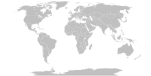
Talaksan:Island nations.svg

Size of this PNG preview of this SVG file: 800 x 411 na pixel. Ibang mga resolusyon: 320 x 164 na pixel | 640 x 329 na pixel | 1,024 x 526 na pixel | 1,280 x 657 na pixel | 2,560 x 1,314 na pixel | 863 x 443 na pixel.
Buong resolusyon ((Larawang SVG, tinatayang 863 × 443 mga pixel, laki ng talakasan: 1.55 MB))
Nakaraan ng file
Pindutin ang araw/oras upang makita kung papaano ang itsura ng talaksan noong oras na iyon.
| Araw/Oras | Thumbnail | Mga dimensiyon | tagagamit | Kumento | |
|---|---|---|---|---|---|
| ngayon | 11:15, 25 Setyembre 2023 |  | 863 × 443 (1.55 MB) | Seabourn101 | Reverted to version as of 22:34, 31 May 2023 (UTC) |
| 18:55, 12 Setyembre 2023 |  | 863 × 443 (1.55 MB) | Taekhosong | Reverted to version as of 09:33, 1 August 2018 (UTC) | |
| 22:34, 31 Mayo 2023 |  | 863 × 443 (1.55 MB) | Przemub | Reverted to version as of 16:20, 5 April 2023 (UTC). Another land border there is the one with Akrotiri and Dhekelia, which is internationally recognised. | |
| 08:27, 7 Abril 2023 |  | 863 × 443 (1.59 MB) | Discombobulates | Cyprus shouldn't have a land border, the TRNC is recognised only by one country, its occupier | |
| 16:20, 5 Abril 2023 |  | 863 × 443 (1.55 MB) | Jeffhardyfan08 | wrong file | |
| 16:20, 5 Abril 2023 |  | 1,000 × 514 (27 KB) | Jeffhardyfan08 | Added Greenland | |
| 06:38, 25 Abril 2022 |  | 863 × 443 (1.55 MB) | Seabourn101 | Reverted to version as of 15:08, 1 September 2018 (UTC)- revert Unexplained reversion | |
| 04:26, 20 Abril 2022 |  | 863 × 443 (1.55 MB) | Vodi.Dino.Eri | Reverted to version as of 20:31, 18 December 2015 (UTC) | |
| 15:08, 1 Setyembre 2018 |  | 863 × 443 (1.55 MB) | 行到水穷处 | Reverted to version as of 16:05, 15 August 2018 (UTC) (as discussed) | |
| 14:05, 1 Setyembre 2018 |  | 863 × 443 (1.55 MB) | 行到水穷处 | Reverted to version as of 09:33, 1 August 2018 (UTC) (No specific comment is provided for the last edit) |
Mga ugnay
Nakaturo sa talaksan na ito ang mga sumusunod na mga pahina:
Pandaigdigang paggamit sa file
Ginagamit ng mga sumusunod na wiki ang file na ito:
- Paggamit sa af.wikipedia.org
- Paggamit sa ar.wikipedia.org
- Paggamit sa az.wikipedia.org
- Paggamit sa bn.wikipedia.org
- Paggamit sa bs.wikipedia.org
- Paggamit sa ca.wikipedia.org
- Paggamit sa ckb.wikipedia.org
- Paggamit sa da.wikipedia.org
- Paggamit sa de.wikipedia.org
- Paggamit sa en.wikipedia.org
- Paggamit sa eo.wikipedia.org
- Paggamit sa et.wikipedia.org
- Paggamit sa eu.wikipedia.org
- Paggamit sa fa.wikipedia.org
- Paggamit sa fa.wikibooks.org
- Paggamit sa fi.wikipedia.org
- Paggamit sa fr.wikipedia.org
- Paggamit sa fr.wiktionary.org
- Paggamit sa gag.wikipedia.org
- Paggamit sa gl.wikipedia.org
- Paggamit sa he.wikipedia.org
- Paggamit sa hi.wikipedia.org
- Paggamit sa hu.wikipedia.org
- Paggamit sa ia.wikipedia.org
- Paggamit sa id.wikipedia.org
- Paggamit sa ig.wikipedia.org
- Paggamit sa ilo.wikipedia.org
- Paggamit sa inh.wikipedia.org
- Paggamit sa is.wiktionary.org
- Paggamit sa it.wikipedia.org
- Paggamit sa ja.wikipedia.org
- Paggamit sa ko.wikipedia.org
- Paggamit sa la.wikipedia.org
Tingnan ang karagdagang pandaigdigang paggamit sa file na ito.


