
Talaksan:Jebi 2018-08-31 0330Z.jpg

Laki ng pasilip na ito: 450 x 600 na pixel. Ibang resolusyon: 180 x 240 na pixel | 360 x 480 na pixel | 576 x 768 na pixel | 768 x 1,024 na pixel | 1,800 x 2,400 na pixel.
Buong resolusyon ((1,800 × 2,400 pixel, laki ng talaksan: 1.57 MB, uri ng MIME: image/jpeg))
|
|
Ito ay isang talaksan mula sa Wikimedia Commons. Makikita sa ibaba ang impormasyon mula sa pahina ng paglalarawan nito roon. |
Buod
| Paglalarawan |
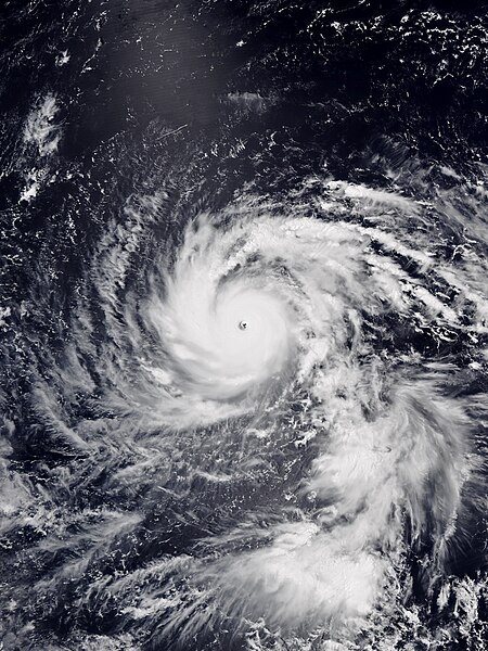
English: Typhoon Jebi at peak intensity west of the Northern Mariana Islands on August 31, 2018. |
| Petsa | |
| Pinanggalingan | Satellite Maps - Global Archive from NOAA NESDIS |
| May-akda | VIIRS image captured by NOAA’s NOAA-20 satellite |
| Camera location | | View this and other nearby images on: OpenStreetMap |
|---|
Paglilisensiya
This image is in the public domain because it contains materials that originally came from the U.S. National Oceanic and Atmospheric Administration, taken or made as part of an employee's official duties.
|
Nakaraan ng file
Pindutin ang araw/oras upang makita kung papaano ang itsura ng talaksan noong oras na iyon.
| Araw/Oras | Thumbnail | Mga dimensiyon | tagagamit | Kumento | |
|---|---|---|---|---|---|
| ngayon | 06:33, 2 Setyembre 2018 | | 1,800 × 2,400 (1.57 MB) | Meow | User created page with UploadWizard |
Mga ugnay
Nakaturo sa talaksan na ito ang mga sumusunod na mga pahina:
Pandaigdigang paggamit sa file
Ginagamit ng mga sumusunod na wiki ang file na ito:
- Paggamit sa ar.wikipedia.org
- Paggamit sa en.wikipedia.org
- Paggamit sa es.wikipedia.org
- Paggamit sa fa.wikipedia.org
- Paggamit sa fr.wikipedia.org
- Paggamit sa ko.wikipedia.org
- Paggamit sa pt.wikipedia.org
- Paggamit sa ru.wikipedia.org
- Paggamit sa th.wikipedia.org
- Paggamit sa zh-yue.wikipedia.org
- Paggamit sa zh.wikipedia.org