
Talaksan:Niger sm03.png

Walang resolusyong mataas.
Niger_sm03.png ((330 × 355 pixel, laki ng talaksan: 8 KB, uri ng MIME: image/png))
|
|
Ito ay isang talaksan mula sa Wikimedia Commons. Makikita sa ibaba ang impormasyon mula sa pahina ng paglalarawan nito roon. |
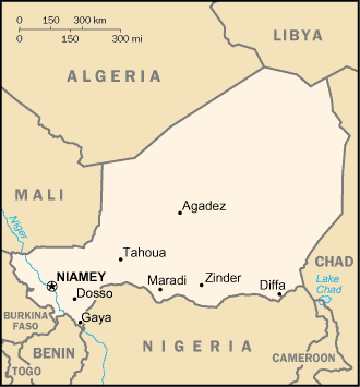
| Paglalarawan |
English: Map of Niger. |
| Pinanggalingan | CIA World Factbook (via http://www.lib.utexas.edu/maps/cia03/niger_sm03.gif |
| May-akda | CIA |
Paglilisensiya
This image is in the public domain because it contains materials that originally came from the United States Central Intelligence Agency's World Factbook.
|
 |
Tala ng orihinal na pagkarga
The original description page was here. All following user names refer to en.wikipedia.
- 2003-09-27 09:44 Pascal 330×355× (8549 bytes) Map of Niger from http://www.lib.utexas.edu/maps/cia03/niger_sm03.gif from the University of Texas site
Nakaraan ng file
Pindutin ang araw/oras upang makita kung papaano ang itsura ng talaksan noong oras na iyon.
| Araw/Oras | Thumbnail | Mga dimensiyon | tagagamit | Kumento | |
|---|---|---|---|---|---|
| ngayon | 13:48, 19 Mayo 2009 | | 330 × 355 (8 KB) | File Upload Bot (Magnus Manske) | {{BotMoveToCommons|en.wikipedia|year={{subst:CURRENTYEAR}}|month={{subst:CURRENTMONTHNAME}}|day={{subst:CURRENTDAY}}}} {{Information |Description={{en|Map of Niger.}} |Source=Transferred from [http://en.wikipedia.org en.wikipedia]; transferred to Commons |
Mga ugnay
Nakaturo sa talaksan na ito ang mga sumusunod na mga pahina:
Pandaigdigang paggamit sa file
Ginagamit ng mga sumusunod na wiki ang file na ito:
- Paggamit sa bn.wikipedia.org
- Paggamit sa bs.wikipedia.org
- Paggamit sa en.wikipedia.org
- Paggamit sa es.wikipedia.org
- Paggamit sa ha.wikipedia.org
- Paggamit sa hr.wikipedia.org
- Paggamit sa id.wikipedia.org
- Paggamit sa ig.wikipedia.org
- Paggamit sa it.wikipedia.org
- Paggamit sa ja.wikipedia.org
- Paggamit sa ka.wikipedia.org
- Paggamit sa kk.wikipedia.org
- Paggamit sa km.wikipedia.org
- Paggamit sa pl.wikipedia.org
- Paggamit sa sco.wikipedia.org
- Paggamit sa sv.wikipedia.org
- Paggamit sa sw.wikipedia.org
- Paggamit sa xmf.wikipedia.org