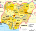
Talaksan:Nigeria political.png
Nigeria_political.png ((567 × 482 pixel, laki ng talaksan: 183 KB, uri ng MIME: image/png))
Nakaraan ng file
Pindutin ang araw/oras upang makita kung papaano ang itsura ng talaksan noong oras na iyon.
| Araw/Oras | Thumbnail | Mga dimensiyon | tagagamit | Kumento | |
|---|---|---|---|---|---|
| ngayon | 23:23, 24 Setyembre 2015 |  | 567 × 482 (183 KB) | Jamie Tubers | Changed "Federal Capital" to "Federal Capital Territory" |
| 02:52, 28 Marso 2009 |  | 567 × 482 (145 KB) | Xandar | {{Information |Description=Political map of the 36 en:States of Nigeria |Source= |Date=27.3.2009 |Author=xandar adapted from Domenico-de-ga |Permission=Released under the GNU Free Documentation License. |other_versions=Datei:Nigeria-karte-politisch.pn |
Mga ugnay
Nakaturo sa talaksan na ito ang mga sumusunod na mga pahina:
Pandaigdigang paggamit sa file
Ginagamit ng mga sumusunod na wiki ang file na ito:
- Paggamit sa af.wikipedia.org
- Paggamit sa am.wikipedia.org
- Paggamit sa an.wikipedia.org
- Paggamit sa ar.wikipedia.org
- Paggamit sa bjn.wikipedia.org
- Paggamit sa ca.wikipedia.org
- Estat d'Adamawa
- Abuja
- Estat d'Oyo
- Estat de Sokoto
- Ogun
- Abia
- Estats de Nigèria
- Anambra
- Ebonyi
- Imo
- Estat d'Enugu
- Cross River
- Akwa Ibom
- Plantilla:Estats de Nigèria
- Rivers
- Bayelsa
- Estat del Delta
- Estat de Zamfara
- Yobe
- Estat de Bauchi
- Territori de la Capital Federal (Nigèria)
- Estat de Benue
- Estat de Borno
- Estat Edo
- Estat Ekiti
- Estat de Gombe
- Jigawa
- Estat de Kaduna
- Estat de Kano
- Estat de Katsina
- Estat de Kebbi
- Estat de Kogi
- Kwara
- Estat de Lagos
- Estat de Nasarawa
- Estat del Níger
- Estat d'Osun
- Estat d'Ondo
- Estat de Plateau
- Estat de Taraba
- Paggamit sa cs.wikipedia.org
- Paggamit sa da.wikipedia.org
- Paggamit sa en.wikipedia.org
Tingnan ang karagdagang pandaigdigang paggamit sa file na ito.


