
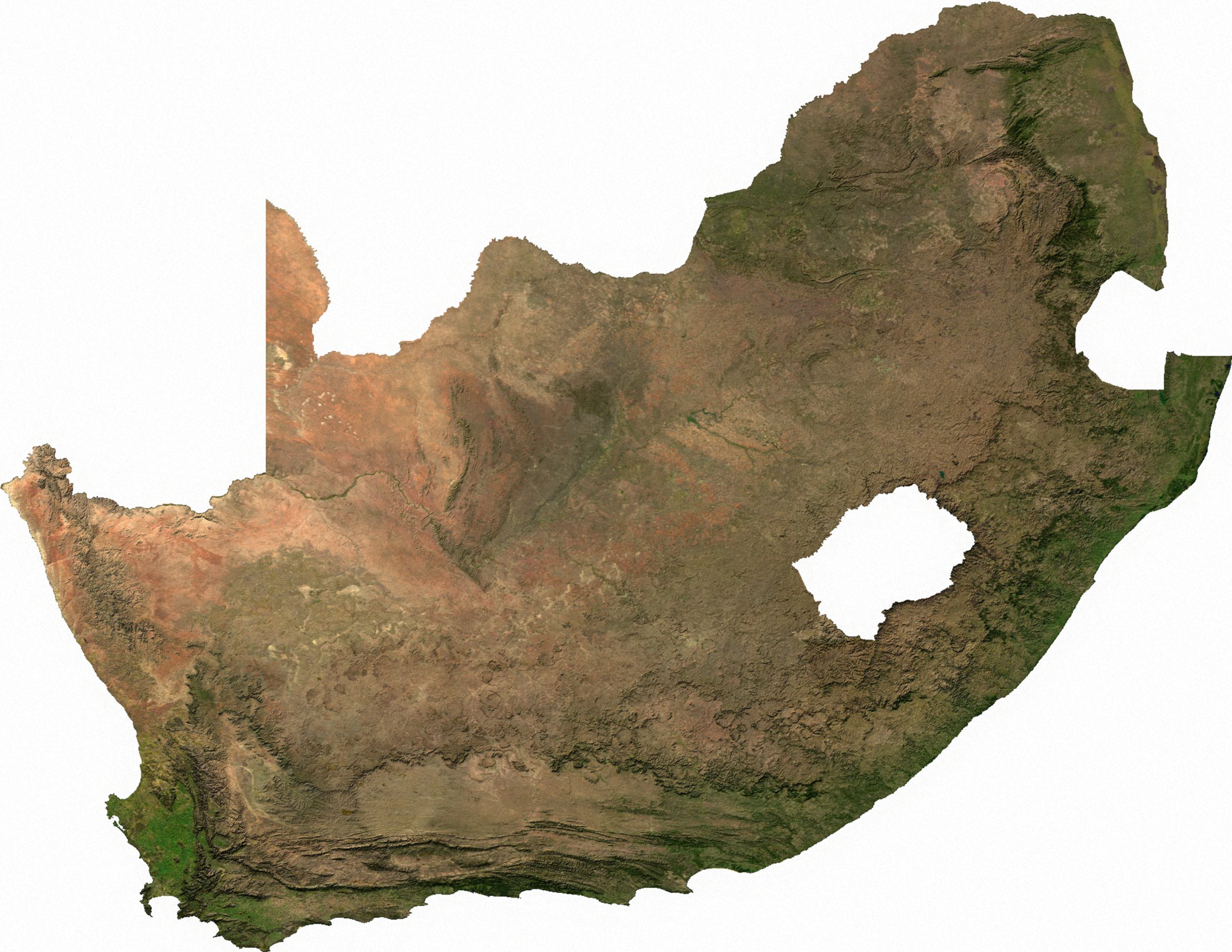
Talaksan:South Africa sat.jpg
Buong resolusyon ((1,974 × 1,527 pixel, laki ng talaksan: 1.89 MB, uri ng MIME: image/jpeg))
|
|
Ito ay isang talaksan mula sa Wikimedia Commons. Makikita sa ibaba ang impormasyon mula sa pahina ng paglalarawan nito roon. |

|
This file has been superseded by South Africa sat.png. It is recommended to use the other file. Please note that deleting superseded images requires consent.
|

|
ECW to TIFF to JPEG (100% quality; progressive formatting).
| This file is in the public domain, because it was generated by a user, using free sources available at The Map Library.
Note that this does not include the maps in the Global Administrative Areas section of the homepage. |
Nakaraan ng file
Pindutin ang araw/oras upang makita kung papaano ang itsura ng talaksan noong oras na iyon.
| Araw/Oras | Thumbnail | Mga dimensiyon | tagagamit | Kumento | |
|---|---|---|---|---|---|
| ngayon | 02:51, 14 Hulyo 2006 | | 1,974 × 1,527 (1.89 MB) | Unquietwiki | ECW to TIFF to JPEG (100% quality; progressive formatting). {{PD-MapLibrary}} |
Mga ugnay
Nakaturo sa talaksan na ito ang mga sumusunod na mga pahina:
Pandaigdigang paggamit sa file
Ginagamit ng mga sumusunod na wiki ang file na ito:
- Paggamit sa af.wikipedia.org
- Paggamit sa ar.wikipedia.org
- Paggamit sa ast.wikipedia.org
- Paggamit sa bg.wikipedia.org
- Paggamit sa ca.wikipedia.org
- Paggamit sa de.wikipedia.org
- Paggamit sa en.wikipedia.org
- Paggamit sa es.wikipedia.org
- Paggamit sa fa.wikipedia.org
- Paggamit sa fi.wikipedia.org
- Paggamit sa fr.wikipedia.org
- Paggamit sa he.wikipedia.org
- Paggamit sa hu.wikipedia.org
- Paggamit sa hy.wikipedia.org
- Paggamit sa it.wikipedia.org
- Paggamit sa ja.wikipedia.org
- Paggamit sa ka.wikipedia.org
- Paggamit sa la.wikipedia.org
- Paggamit sa lv.wikipedia.org
- Paggamit sa ml.wikipedia.org
- Paggamit sa mwl.wikipedia.org
- Paggamit sa no.wikipedia.org
- Paggamit sa nso.wikipedia.org
- Paggamit sa pt.wikipedia.org
- Paggamit sa rm.wikipedia.org
- Paggamit sa ru.wikipedia.org
- Paggamit sa simple.wikipedia.org
- Paggamit sa th.wikipedia.org
- Paggamit sa tr.wikipedia.org
- Paggamit sa tum.wikipedia.org
- Paggamit sa uk.wikipedia.org
- Геологія Південно-Африканської Республіки
- Економіка Південно-Африканської Республіки
- Гідрогеологія Південно-Африканської Республіки
- Корисні копалини Південно-Африканської Республіки
- Гірнича промисловість Південно-Африканської Республіки
- Шаблон:Геологія ПАР
- Вікіпедія:Шаблони/Навігаційні/Геологія
- Історія освоєння мінеральних ресурсів Південно-Африканської Республіки
Tingnan ang karagdagang pandaigdigang paggamit sa file na ito.