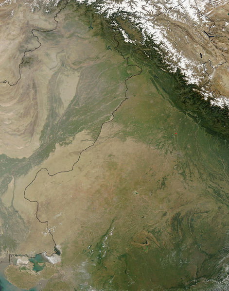
Talaksan:Thar Desert satellite.jpg

Laki ng pasilip na ito: 471 x 599 na pixel. Ibang resolusyon: 189 x 240 na pixel | 500 x 636 na pixel.
Buong resolusyon ((500 × 636 pixel, laki ng talaksan: 329 KB, uri ng MIME: image/jpeg))
Nakaraan ng file
Pindutin ang araw/oras upang makita kung papaano ang itsura ng talaksan noong oras na iyon.
| Araw/Oras | Thumbnail | Mga dimensiyon | tagagamit | Kumento | |
|---|---|---|---|---|---|
| ngayon | 14:25, 17 Setyembre 2005 |  | 500 × 636 (329 KB) | Crux | Satellite Image of Thar Desert, India/Pakistan (border line in the middle) from en:, uploaded by en:User:Tom Radulovich |
Mga ugnay
Nakaturo sa talaksan na ito ang mga sumusunod na mga pahina:
Pandaigdigang paggamit sa file
Ginagamit ng mga sumusunod na wiki ang file na ito:
- Paggamit sa ar.wikipedia.org
- Paggamit sa az.wikipedia.org
- Paggamit sa bg.wikipedia.org
- Paggamit sa bn.wikipedia.org
- Paggamit sa bs.wikipedia.org
- Paggamit sa ckb.wikipedia.org
- Paggamit sa de.wikipedia.org
- Paggamit sa en.wikipedia.org
- Paggamit sa eo.wikipedia.org
- Paggamit sa es.wikipedia.org
- Paggamit sa et.wikipedia.org
- Paggamit sa fa.wikipedia.org
- Paggamit sa fi.wikipedia.org
- Paggamit sa fr.wikipedia.org
- Paggamit sa he.wikipedia.org
- Paggamit sa hu.wikipedia.org
- Paggamit sa it.wikipedia.org
- Paggamit sa ja.wikipedia.org
- Paggamit sa ka.wikipedia.org
- Paggamit sa kk.wikipedia.org
- Paggamit sa kn.wikipedia.org
- Paggamit sa ko.wikipedia.org
- Paggamit sa ky.wikipedia.org
- Paggamit sa lfn.wikipedia.org
- Paggamit sa lt.wikipedia.org
- Paggamit sa mai.wikipedia.org
- Paggamit sa mg.wikipedia.org
- Paggamit sa mk.wikipedia.org
- Paggamit sa ml.wikipedia.org
- Paggamit sa mr.wikipedia.org
- Paggamit sa ms.wikipedia.org
- Paggamit sa ne.wikipedia.org
- Paggamit sa nn.wikipedia.org
- Paggamit sa pa.wikipedia.org
- Paggamit sa pl.wikipedia.org
- Paggamit sa pnb.wikipedia.org
Tingnan ang karagdagang pandaigdigang paggamit sa file na ito.


