
Talaksan:Volgograd 44.67670E 48.66724N.jpg

Laki ng pasilip na ito: 800 x 599 na pixel. Ibang mga resolusyon: 320 x 240 na pixel | 640 x 479 na pixel | 1,024 x 766 na pixel | 1,280 x 958 na pixel.
Buong resolusyon ((1,280 × 958 pixel, laki ng talaksan: 262 KB, uri ng MIME: image/jpeg))
|
|
Ito ay isang talaksan mula sa Wikimedia Commons. Makikita sa ibaba ang impormasyon mula sa pahina ng paglalarawan nito roon. |
Buod
| Paglalarawan |
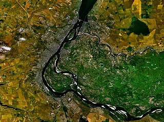
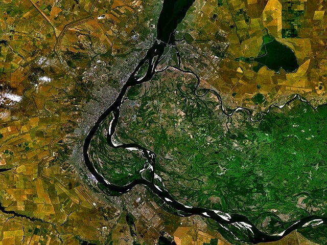
English: Volgograd, Russia |
| Petsa | 19 Mayo 2005 (upload date) |
| Pinanggalingan | Satellite imagery taken from NASA World Wind software (by screenshot) |
| May-akda | NASA |
| Object location | | View this and other nearby images on: OpenStreetMap |
|---|
Paglilisensiya
| This image is in the public domain because it is a screenshot from NASA’s globe software World Wind using a public domain layer, such as Blue Marble, MODIS, Landsat, SRTM, USGS or GLOBE.
|
 |
Nakaraan ng file
Pindutin ang araw/oras upang makita kung papaano ang itsura ng talaksan noong oras na iyon.
| Araw/Oras | Thumbnail | Mga dimensiyon | tagagamit | Kumento | |
|---|---|---|---|---|---|
| ngayon | 18:44, 19 Mayo 2005 | | 1,280 × 958 (262 KB) | Rex | Volgograd, Russia {{World Wind}} Category:Maps of Russia |
Mga ugnay
Nakaturo sa talaksan na ito ang mga sumusunod na mga pahina:
Pandaigdigang paggamit sa file
Ginagamit ng mga sumusunod na wiki ang file na ito:
- Paggamit sa ar.wikipedia.org
- Paggamit sa as.wikipedia.org
- Paggamit sa bh.wikipedia.org
- Paggamit sa bn.wikipedia.org
- Paggamit sa cy.wikipedia.org
- Paggamit sa el.wikipedia.org
- Paggamit sa en.wikipedia.org
- Paggamit sa et.wikipedia.org
- Paggamit sa fr.wikipedia.org
- Paggamit sa ha.wikipedia.org
- Paggamit sa he.wikipedia.org
- Paggamit sa hr.wikipedia.org
- Paggamit sa lad.wikipedia.org
- Paggamit sa nl.wikipedia.org
- Paggamit sa no.wikipedia.org
- Paggamit sa pa.wikipedia.org
- Paggamit sa pnb.wikipedia.org
- Paggamit sa sh.wikipedia.org
- Paggamit sa simple.wikipedia.org
- Paggamit sa sl.wikipedia.org
- Paggamit sa sv.wikipedia.org
- Paggamit sa ta.wikipedia.org
- Paggamit sa ur.wikipedia.org
- Paggamit sa zh.wikipedia.org