
Talaksan:Wutip 2019-02-25 0345Z.jpg
Laki ng pasilip na ito: 450 x 600 na pixel. Ibang mga resolusyon: 180 x 240 na pixel | 360 x 480 na pixel | 576 x 768 na pixel | 768 x 1,024 na pixel | 1,536 x 2,048 na pixel | 4,200 x 5,600 na pixel.
Buong resolusyon ((4,200 × 5,600 pixel, laki ng talaksan: 6.1 MB, uri ng MIME: image/jpeg))
|
|
Ito ay isang talaksan mula sa Wikimedia Commons. Makikita sa ibaba ang impormasyon mula sa pahina ng paglalarawan nito roon. |
Buod
| Paglalarawan |
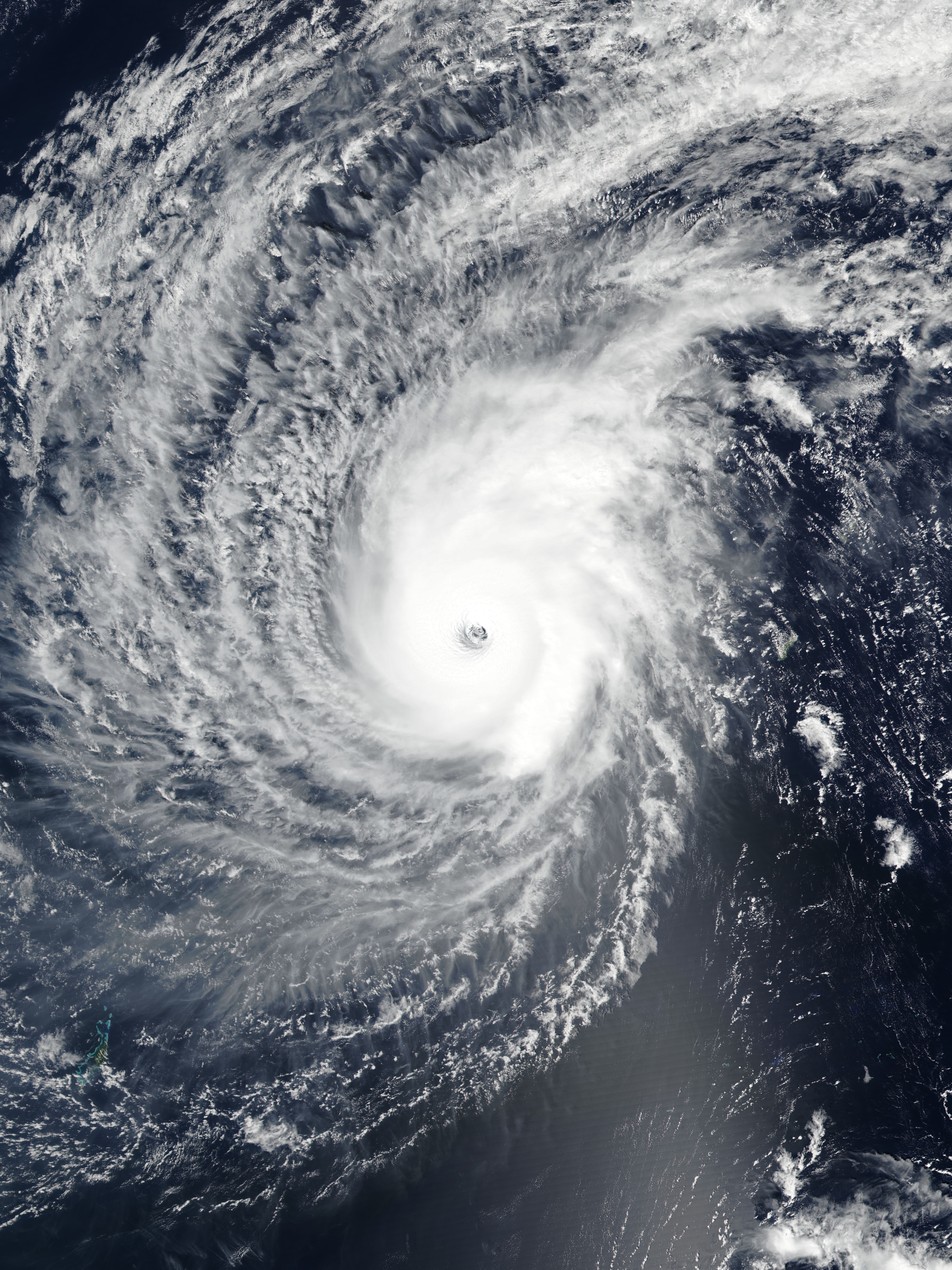
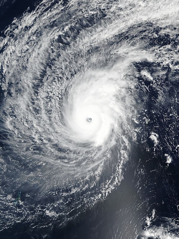
English: Typhoon Wutip near its secondary peak intensity west of Guam on February 25, 2019. |
| Petsa | |
| Pinanggalingan | EOSDIS Worldview |
| May-akda | VIIRS image captured by NOAA’s Suomi NPP satellite |
| Camera location | | View this and other nearby images on: OpenStreetMap |
|---|
Paglilisensiya
| This file is in the public domain in the United States because it was solely created by NASA. NASA copyright policy states that "NASA material is not protected by copyright unless noted". (See Template:PD-USGov, NASA copyright policy page or JPL Image Use Policy.) | ||
 |
Warnings:
|
Nakaraan ng file
Pindutin ang araw/oras upang makita kung papaano ang itsura ng talaksan noong oras na iyon.
| Araw/Oras | Thumbnail | Mga dimensiyon | tagagamit | Kumento | |
|---|---|---|---|---|---|
| ngayon | 13:58, 25 Pebrero 2019 | | 4,200 × 5,600 (6.1 MB) | Meow | Rebuilt and optimised the picture with the accurate resolution (375m), the proper ratio (also narrowed to 97.6%), and the correct location of the center. |
| 11:49, 25 Pebrero 2019 |  | 6,401 × 8,001 (3.84 MB) | Nino Marakot | 250m resolution | |
| 07:29, 25 Pebrero 2019 |  | 1,324 × 1,839 (350 KB) | ElenaCyclone | User created page with UploadWizard |
Mga ugnay
Nakaturo sa talaksan na ito ang mga sumusunod na mga pahina:
Pandaigdigang paggamit sa file
Ginagamit ng mga sumusunod na wiki ang file na ito:
- Paggamit sa en.wikipedia.org
- Portal:Tropical cyclones/Anniversaries/February
- Portal:Tropical cyclones/Anniversaries/February/23
- Wikipedia:WikiProject Tropical cyclones/Newsletter/Archive 35
- User talk:CooperScience
- User talk:KN2731/Archive 2
- Tropical cyclones in 2019
- User talk:Hurricane Noah/Archive 2
- User talk:Nova Crystallis/Archive 5
- User talk:Yellow Evan/Archive 28
- Paggamit sa es.wikipedia.org
- Paggamit sa ja.wikipedia.org
- Paggamit sa ko.wikipedia.org
- Paggamit sa pt.wikipedia.org
- Paggamit sa th.wikipedia.org
- Paggamit sa zh-yue.wikipedia.org
- Paggamit sa zh.wikipedia.org