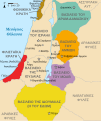
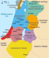
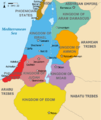
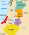
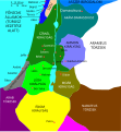
Talaksan:Kingdoms around Israel 830 map.svg

Size of this PNG preview of this SVG file: 502 x 599 na pixel. Ibang mga resolusyon: 201 x 240 na pixel | 402 x 480 na pixel | 644 x 768 na pixel | 858 x 1,024 na pixel | 1,717 x 2,048 na pixel | 720 x 859 na pixel.
Buong resolusyon ((Larawang SVG, tinatayang 720 × 859 mga pixel, laki ng talakasan: 122 KB))
Nakaraan ng file
Pindutin ang araw/oras upang makita kung papaano ang itsura ng talaksan noong oras na iyon.
| Araw/Oras | Thumbnail | Mga dimensiyon | tagagamit | Kumento | |
|---|---|---|---|---|---|
| ngayon | 15:32, 29 Oktubre 2022 |  | 720 × 859 (122 KB) | Muchado | Fixing font problems (hopefully) |
| 15:11, 29 Oktubre 2022 | 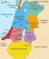 | 720 × 859 (283 KB) | Muchado | Added "Philistine City States" which was unintentionally missed off... | |
| 15:06, 29 Oktubre 2022 |  | 720 × 859 (239 KB) | Muchado | Coloured states, removed anachronistic Petra, added Bozrah, removed Urmomium (Your mom...!), edited Arabu to Arubu, edited to Philistine City States | |
| 15:51, 10 Pebrero 2017 |  | 720 × 859 (167 KB) | Malus Catulus | Removed 'Sizu' - a weird artifact from the Norse original | |
| 12:58, 13 Hulyo 2010 |  | 720 × 859 (165 KB) | Malus Catulus | livened up the colors, converted med sea text to path | |
| 11:26, 13 Hulyo 2010 |  | 720 × 859 (139 KB) | Malus Catulus | {{Information |Description={{en|1=Map showing the ancient levant borders and ancient cities such as Urmomium and Jerash. The Kingdoms around Israel and Judah are colored. The map also shows the region in the 9th century BCE. Notice the coastal lan |
Mga ugnay
Nakaturo sa talaksan na ito ang mga sumusunod na mga pahina:
Pandaigdigang paggamit sa file
Ginagamit ng mga sumusunod na wiki ang file na ito:
- Paggamit sa af.wikipedia.org
- Paggamit sa arc.wikipedia.org
- Paggamit sa ar.wikipedia.org
- Paggamit sa arz.wikipedia.org
- Paggamit sa azb.wikipedia.org
- Paggamit sa bg.wikipedia.org
- Paggamit sa bn.wikipedia.org
- Paggamit sa br.wikipedia.org
- Paggamit sa ca.wikipedia.org
- Paggamit sa cs.wikipedia.org
- Paggamit sa da.wikipedia.org
- Paggamit sa en.wikipedia.org
- Ammon
- History of the ancient Levant
- Kingdom of Judah
- Kingdom of Israel (Samaria)
- Philistines
- Moab
- Philistia
- Talk:Phoenician language
- Aram-Damascus
- Edom
- Portal:Bible/Featured chapter/Psalms
- Portal:Bible/Featured chapter/Psalms 83
- User:Kazkaskazkasako/Books/History
- Transjordan (region)
- Ezekiel 25
- User:Falcaorib
- User:Jacksonmcdonald3425/sandbox
- Paggamit sa en.wiktionary.org
- Paggamit sa eo.wikipedia.org
- Paggamit sa et.wikipedia.org
- Paggamit sa eu.wikipedia.org
Tingnan ang karagdagang pandaigdigang paggamit sa file na ito.


