
Talaksan:Corbin Bridge.jpg
Laki ng pasilip na ito: 800 x 550 na pixel. Ibang mga resolusyon: 320 x 220 na pixel | 640 x 440 na pixel | 1,024 x 704 na pixel | 1,280 x 880 na pixel | 2,560 x 1,759 na pixel | 4,673 x 3,211 na pixel.
Buong resolusyon ((4,673 × 3,211 pixel, laki ng talaksan: 2.62 MB, uri ng MIME: image/jpeg))
|
|
Ito ay isang talaksan mula sa Wikimedia Commons. Makikita sa ibaba ang impormasyon mula sa pahina ng paglalarawan nito roon. |
|
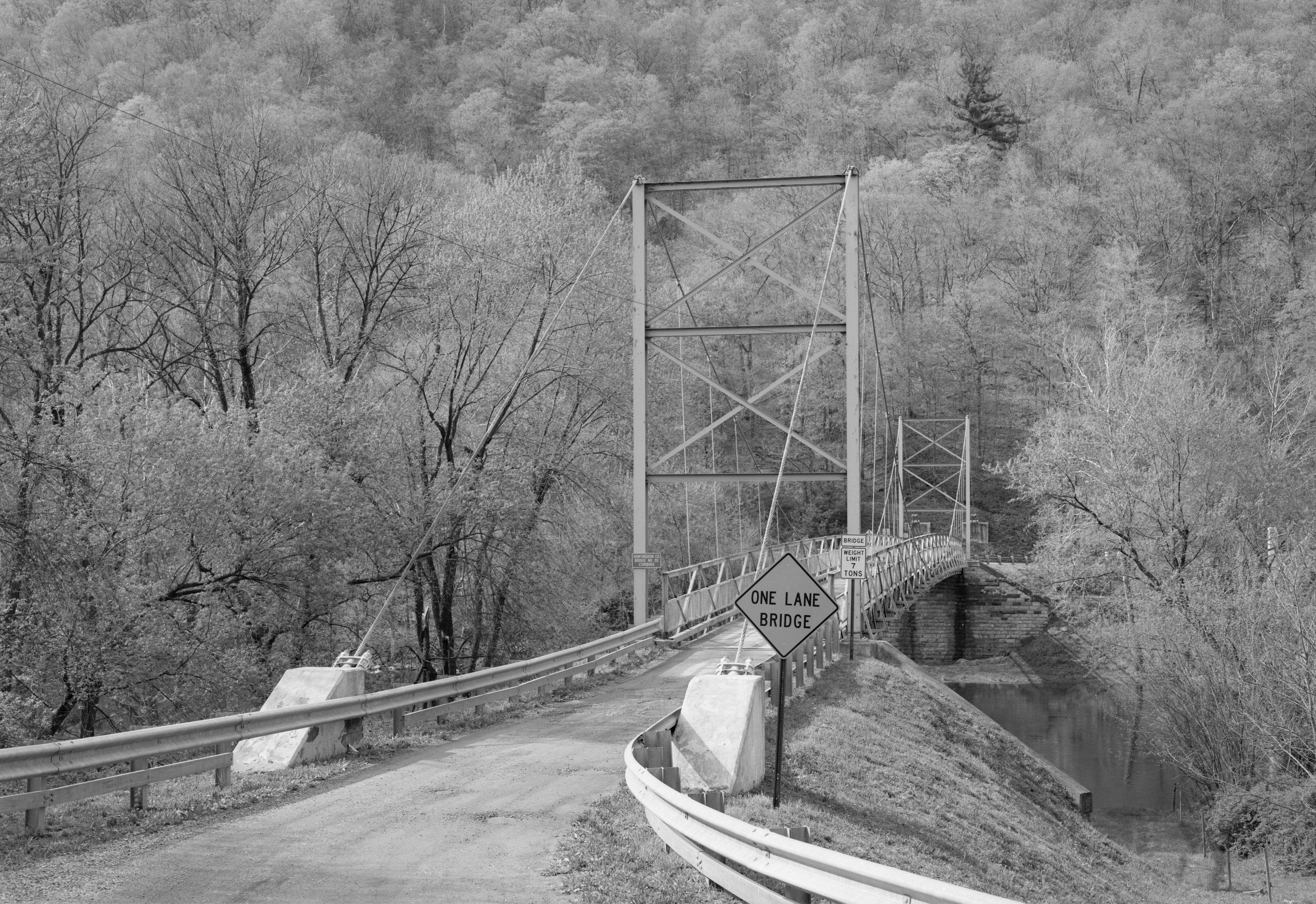
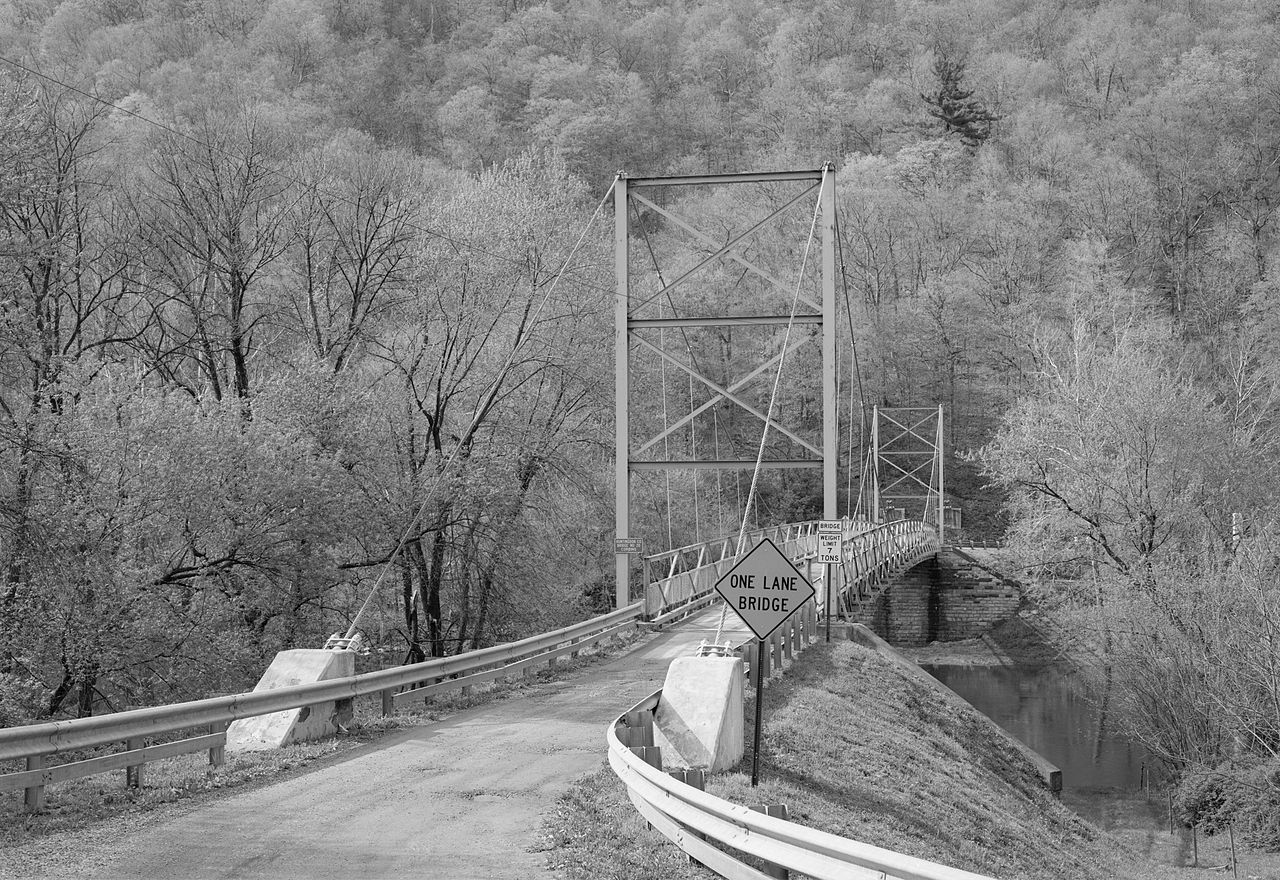
This is an image of a place or building that is listed on the National Register of Historic Places in the United States of America. Its reference number is 90000402. |
| Camera location | | View this and other nearby images on: OpenStreetMap |
|---|
| Paglalarawan |
English: Eastern end of the Corbin Bridge, which carries Township Road 428 over the Raystown Branch Juniata River southwest of Huntingdon in Juniata Township, Huntingdon County, Pennsylvania, United States. Built in 1937, this suspension bridge is listed on the National Register of Historic Places. |
|||||||||||||||||||||||
| Petsa | ||||||||||||||||||||||||
| Pinanggalingan | Library of Congress, Prints and Photograph Division HAER: PA,31-HUDO.V,1-1 | |||||||||||||||||||||||
| May-akda |
|
|||||||||||||||||||||||
| Permiso (Muling paggamit sa file) |
|
|||||||||||||||||||||||
.jpg)

|
This image is available from the United States Library of Congress's Prints and Photographs division
under the digital ID hhh.pa2739. This tag does not indicate the copyright status of the attached work. A normal copyright tag is still required. See Commons:Licensing.
|
Nakaraan ng file
Pindutin ang araw/oras upang makita kung papaano ang itsura ng talaksan noong oras na iyon.
| Araw/Oras | Thumbnail | Mga dimensiyon | tagagamit | Kumento | |
|---|---|---|---|---|---|
| ngayon | 15:26, 20 Disyembre 2009 | | 4,673 × 3,211 (2.62 MB) | Nyttend | {{Location|40|27|16|N|77|59|0|W}} {{Information |Description={{en|Eastern end of the {{w|Corbin Bridge}}, which carries Township Road 428 over the {{w|Raystown Branch Juniata River}} southwest of {{w|Huntingdon, Pennsylvania|Huntingdon}} in {{w|Juniata To |
Mga ugnay
Nakaturo sa talaksan na ito ang mga sumusunod na mga pahina:
Pandaigdigang paggamit sa file
Ginagamit ng mga sumusunod na wiki ang file na ito:
- Paggamit sa en.wikipedia.org
- Paggamit sa www.wikidata.org