
Talaksan:ISS006-E-38029 - View of the Lesser Antilles.jpg

Laki ng pasilip na ito: 800 x 545 na pixel. Ibang mga resolusyon: 320 x 218 na pixel | 640 x 436 na pixel | 1,024 x 697 na pixel | 1,280 x 871 na pixel | 2,560 x 1,743 na pixel | 3,032 x 2,064 na pixel.
Buong resolusyon ((3,032 × 2,064 pixel, laki ng talaksan: 945 KB, uri ng MIME: image/jpeg))
|
|
Ito ay isang talaksan mula sa Wikimedia Commons. Makikita sa ibaba ang impormasyon mula sa pahina ng paglalarawan nito roon. |
Buod
| Paglalarawan |
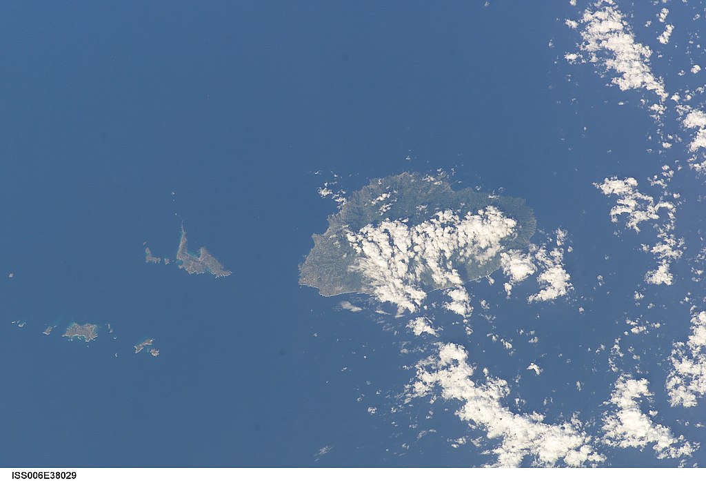
English: View of the Lesser Antilles taken during ISS Expedition 6. |
| Petsa | |
| Pinanggalingan | JSC Gateway to Astronaut Photography of Earth |
| May-akda | Earth Science and Remote Sensing Unit, Lyndon B. Johnson Space Center |
| Mission | ISS006 |
| Roll | E |
| Frame | 38029 |
| Geographic area | the Lesser Antilles |
| Features | SAINT VINCENT AND GRENADINES |
| Cloud percentage | 25% |
| Altitude | 213 nautical miles (394 km) |
| Look angle | 45 |
| Look direction | S |
| Sun Azimuth | 109° |
| Sun Elevation | 40° |
| Camera | Kodak DCS760c Electronic Still Camera |
| Focal length | 180 mm |
| Camera location | | View this and other nearby images on: OpenStreetMap |
|---|
| Object location | | View this and other nearby images on: OpenStreetMap |
|---|
This image or video was catalogued by Johnson Space Center of the United States National Aeronautics and Space Administration (NASA) under Photo ID: ISS006-E-38029. This tag does not indicate the copyright status of the attached work. A normal copyright tag is still required. See Commons:Licensing. Other languages:
|
Paglilisensiya
| This file is in the public domain in the United States because it was solely created by NASA. NASA copyright policy states that "NASA material is not protected by copyright unless noted". (See Template:PD-USGov, NASA copyright policy page or JPL Image Use Policy.) | ||
 |
Warnings:
|
Nakaraan ng file
Pindutin ang araw/oras upang makita kung papaano ang itsura ng talaksan noong oras na iyon.
| Araw/Oras | Thumbnail | Mga dimensiyon | tagagamit | Kumento | |
|---|---|---|---|---|---|
| ngayon | 23:26, 9 Agosto 2022 | | 3,032 × 2,064 (945 KB) | AskeBot |
Mga ugnay
Walang mga pahina ang tumuturo sa talaksang ito.
Pandaigdigang paggamit sa file
Ginagamit ng mga sumusunod na wiki ang file na ito:
- Paggamit sa arz.wikipedia.org
- Paggamit sa ast.wikipedia.org
- Paggamit sa ca.wikipedia.org
- Paggamit sa cy.wikipedia.org
- Paggamit sa dag.wikipedia.org
- Paggamit sa de.wikivoyage.org
- Paggamit sa diq.wikipedia.org
- Paggamit sa eo.wikipedia.org
- Paggamit sa fr.wikivoyage.org
- Paggamit sa ga.wikipedia.org
- Paggamit sa gl.wikipedia.org
- Paggamit sa kab.wikipedia.org
- Paggamit sa pap.wikipedia.org
- Paggamit sa tg.wikipedia.org
- Paggamit sa vec.wikipedia.org
- Paggamit sa www.wikidata.org