
Talaksan:NY Metropolitan Area.png

Laki ng pasilip na ito: 800 x 591 na pixel. Ibang mga resolusyon: 320 x 237 na pixel | 640 x 473 na pixel | 1,024 x 757 na pixel | 1,280 x 946 na pixel | 2,560 x 1,893 na pixel | 4,200 x 3,105 na pixel.
Buong resolusyon ((4,200 × 3,105 pixel, laki ng talaksan: 2.72 MB, uri ng MIME: image/png))
|
|
Ito ay isang talaksan mula sa Wikimedia Commons. Makikita sa ibaba ang impormasyon mula sa pahina ng paglalarawan nito roon. |
Buod
| Paglalarawan |
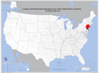
English: Map of Counties with New York Metropolitan Area highlighted. |
| Petsa | |
| Pinanggalingan | https://www2.census.gov/geo/maps/general_ref/us_base/stco2010/USstcou2010_wallmap.pdf |
| May-akda | US Census Bureau, Edited by user Andololol to highlight New York Metropolitan Area. |
Paglilisensiya
This image or file is a work of a United States Census Bureau employee, taken or made as part of that person's official duties. As a work of the U.S. federal government, the image is in the public domain.
|
 |
Nakaraan ng file
Pindutin ang araw/oras upang makita kung papaano ang itsura ng talaksan noong oras na iyon.
| Araw/Oras | Thumbnail | Mga dimensiyon | tagagamit | Kumento | |
|---|---|---|---|---|---|
| ngayon | 19:20, 8 Disyembre 2020 | | 4,200 × 3,105 (2.72 MB) | Brianski | file is painfully slow to download; remove alpha channel, light optimization |
| 03:18, 25 Marso 2016 |  | 4,200 × 3,105 (4.85 MB) | Andololol | User created page with UploadWizard |
Mga ugnay
Nakaturo sa talaksan na ito ang mga sumusunod na mga pahina:
Pandaigdigang paggamit sa file
Ginagamit ng mga sumusunod na wiki ang file na ito:
- Paggamit sa ar.wikipedia.org
- Paggamit sa ast.wikipedia.org
- Paggamit sa bg.wikipedia.org
- Paggamit sa bn.wikipedia.org
- Paggamit sa ca.wikipedia.org
- Paggamit sa en.wikipedia.org
- Paggamit sa eo.wikipedia.org
- Paggamit sa et.wikipedia.org
- Paggamit sa fa.wikipedia.org
- Paggamit sa fi.wikipedia.org
- Paggamit sa fr.wikipedia.org
- Paggamit sa he.wikipedia.org
- Paggamit sa ko.wikipedia.org
- Paggamit sa pt.wikipedia.org
- Paggamit sa sh.wikipedia.org
- Paggamit sa uk.wikipedia.org
- Paggamit sa www.wikidata.org