
Talaksan:Typhoon Chanthu september 10.gif
Walang resolusyong mataas.
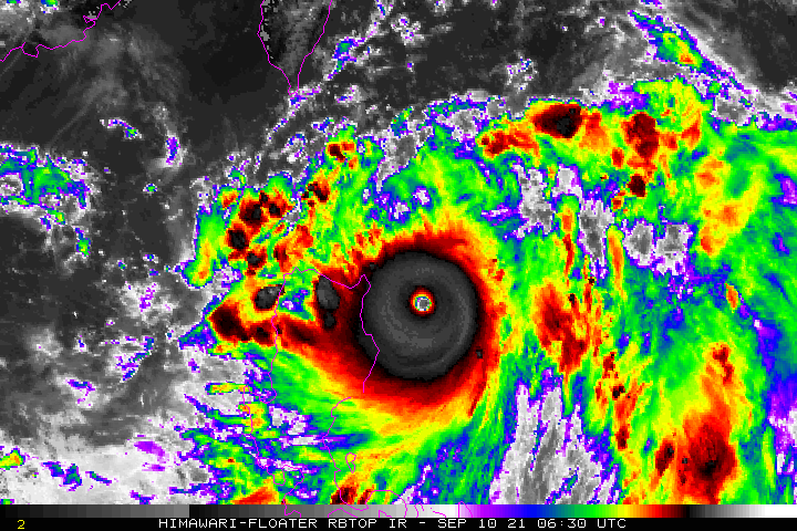
Typhoon_Chanthu_september_10.gif ((720 × 480 pixel, laki ng talaksan: 2.46 MB, uri ng MIME: image/gif), nasilo na, 15 banhay, 3.1 segundo)
|
|
Ito ay isang talaksan mula sa Wikimedia Commons. Makikita sa ibaba ang impormasyon mula sa pahina ng paglalarawan nito roon. |
Buod
| Paglalarawan |
English: Infrared satellite loop of Typhoon Chanthu passing near Luzon on September 10, 2021 |
| Petsa | |
| Pinanggalingan | https://www.ssd.noaa.gov/PS/TROP/floaters/ |
| May-akda | National Oceanic and Atmospheric Administration Satellite Services Division |
Paglilisensiya
This image is in the public domain because it contains materials that originally came from the U.S. National Oceanic and Atmospheric Administration, taken or made as part of an employee's official duties.
|
Nakaraan ng file
Pindutin ang araw/oras upang makita kung papaano ang itsura ng talaksan noong oras na iyon.
| Araw/Oras | Thumbnail | Mga dimensiyon | tagagamit | Kumento | |
|---|---|---|---|---|---|
| ngayon | 20:08, 19 Setyembre 2021 | | 720 × 480 (2.46 MB) | Hurricaneboy23 | Uploaded a work by National Oceanic and Atmospheric Administration Satellite Services Division from https://www.ssd.noaa.gov/PS/TROP/floaters/ with UploadWizard |
Mga ugnay
Nakaturo sa talaksan na ito ang mga sumusunod na mga pahina:
Pandaigdigang paggamit sa file
Ginagamit ng mga sumusunod na wiki ang file na ito:
- Paggamit sa en.wikipedia.org
- Paggamit sa vi.wikipedia.org
- Paggamit sa zh.wikipedia.org