Pumunta sa nilalaman

Talaan ng mga lungsod sa Sri Lanka

Mula sa Wikipedia, ang malayang ensiklopedya
Mapa ng Sri Lanka

Ang sumusunod ay isang talaan ng mga lungsod sa Sri Lanka na may populasyong higit sa 50,000 katao.

Lungsod Retrato Paghahati ng
Divisional Secretary
Distrito Lalawigan Populasyon Lawak[1] Densidad
(/km²)
Mga ko-
ordinato
Conurbation
(Tantiya 2012)[2]
Munisipalidad
(senso 2012)[3]
km² mi²
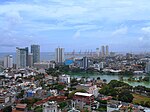
Colombo
කොළඹ
கொழும்பு
Colombo /
Thimbirigasyaya
Colombo Western 752,993 561,314 37 14 15,171 6°56′04″N 79°50′34″E / 6.93444°N 79.84278°E / 6.93444; 79.84278
Dehiwala-
Mount Lavinia

දෙහිවල-
ගල්කිස්ස
தெஹிவளை-
கல்கிசை
Dehiwala Colombo Western 245,974 184,468 21 8 8,784 6°50′23″N 79°52′33″E / 6.83972°N 79.87583°E / 6.83972; 79.87583
Moratuwa
මොරටුව
மொறட்டுவை
Moratuwa Colombo Western 207,755 168,280 23 9 7,317 6°47′57″N 79°52′36″E / 6.79917°N 79.87667°E / 6.79917; 79.87667
Sri Jayawardenapura
Kotte

ශ්‍රී ජයවර්ධනපුර
කෝට්ටේ
ஶ்ரீ ஜெயவர்த்தனபுரம்
கோட்டை
Kotte Colombo Western 135,806 107,925 17 7 6,349 6°54′39″N 79°53′16″E / 6.91083°N 79.88778°E / 6.91083; 79.88778
Negombo
මීගමුව
நீர்கொழும்பு
Negombo Gampaha Western 127,754 142,449 31 12 4,595 7°13′00″N 79°50′00″E / 7.21667°N 79.83333°E / 7.21667; 79.83333
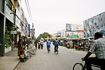
Kandy
මහනුවර
கண்டி
Kandy Kandy Central 125,351 98,828 27 10 3,660 7°17′47″N 80°38′06″E / 7.29639°N 80.63500°E / 7.29639; 80.63500
Kalmunai
කල්මුනේ
கல்முனை
Kalmunai Muslim /
Kalmunai Tamil /
Sainthamarathu
Ampara Eastern 106,783 99,893 23 9 4,343 7°25′00″N 81°49′00″E / 7.41667°N 81.81667°E / 7.41667; 81.81667
Vavuniya
වවුනියාව
வவுனியா
Vavuniya Vavuniya Northern 99,653 34,816 8°45′00″N 80°29′00″E / 8.75000°N 80.48333°E / 8.75000; 80.48333
Galle
ගාල්ල
காலி
Galle Galle Southern 99,478 86,333 17 7 5,078 6°02′03″N 80°12′59″E / 6.03417°N 80.21639°E / 6.03417; 80.21639
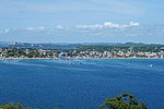
Trincomalee
ත්‍රිකුණාමලය
திருகோணமலை
Trincomalee
Town and
Gravets
Trincomalee Eastern 99,135 48,351 8°34′00″N 81°14′00″E / 8.56667°N 81.23333°E / 8.56667; 81.23333
Batticaloa
මඩකලපුව
மட்டக்களப்பு
Manmunai North Batticaloa Eastern 92,332 86,227 75 29 1,150 7°43′00″N 81°42′00″E / 7.71667°N 81.70000°E / 7.71667; 81.70000
Jaffna
යාපනය
யாழ்ப்பாணம்
Jaffna /
Nallur
Jaffna Northern 88,138 80,829 20 8 4,041 9°40′00″N 80°00′00″E / 9.66667°N 80.00000°E / 9.66667; 80.00000
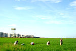
Katunayake
කටුනායක
கட்டுநாயக்க
Katana Gampaha Western 76,816 60,915 7°10′00″N 79°52′00″E / 7.16667°N 79.86667°E / 7.16667; 79.86667
Dambulla
දඹුල්ල
தம்புள்ளை
Dambulla Matale Central 68,821 23,814 54 21 441 7°51′24″N 80°38′57″E / 7.85667°N 80.64917°E / 7.85667; 80.64917
Kolonnawa
කොලොන්නාව
கொலன்னாவ
Kolonnawa Colombo Western 64,887 60,044 6°55′00″N 79°54′00″E / 6.91667°N 79.90000°E / 6.91667; 79.90000
Anuradhapura
අනුරාධපුරය
அனுராதபுரம்
Anuradhapura Anuradhapura North Central 63,208 50,595 36 14 1,405 8°21′00″N 80°23′00″E / 8.35000°N 80.38333°E / 8.35000; 80.38333
Ratnapura
රත්නපුර
இரத்தினபுரி
Ratnapura Ratnapura Sabaragamuwa 52,170 47,105 20 8 2,474 6°40′00″N 80°24′00″E / 6.66667°N 80.40000°E / 6.66667; 80.40000

Mga sanggunian

[baguhin | baguhin ang wikitext]
  1. "Table 15.1: Area, Population, Registered voters and Employees of Municipalities, 2015" (PDF). Statistics Statistical Abstract 2016. Department of Census and Statistics, Sri Lanka. Inarkibo mula sa orihinal (PDF) noong 2019-07-10. Nakuha noong 2017-06-02.{{cite web}}: CS1 maint: date auto-translated (link)
  2. "Sri Lanka: largest cities and towns and statistics of their population". World Gazetteer. Inarkibo mula sa orihinal noong 16 Disyembre 2012. {{cite web}}: Unknown parameter |deadurl= ignored (|url-status= suggested) (tulong)CS1 maint: date auto-translated (link)
  3. "Table 2.4: Population of Municipal Councils and urban councils by sex, Census, 2012" (PDF). Statistics Statistical Abstract 2016. Department of Census and Statistics, Sri Lanka.

Mga ugnay panlabas

[baguhin | baguhin ang wikitext]

Padron:Geography of Sri Lanka